The next few posts I make will not be in any particular order, because I want to share a few trips I’ve made in the last several months, but can’t really be bothered to present them in chronological order for various reasons. So I’m going to start with an attempt I made to climb Mount Shasta in California back in late April.
The trip was conceived by a few friends I have in the climbing gym in Eugene, and they kindly invited me to come along. We drove down to the town of Shasta the morning of April 19, and then drove 8 miles up a dusty and bumpy but very passable dirt road towards the north side of Shasta. Our goal that we had decided on was the Hotlam-Bolam Ridge on the north face of the mountain, which gets far less traffic than the popular standard route up Avalanche Gulch on the south side of the mountain. So much less, in fact, that we didn’t see anyone the entire two days we were up there aside from two other people who were driving down with us and attempting a different route.

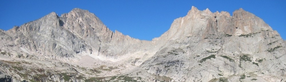
The north side of Shasta from the drive in
We got a fairly late start at about 4 PM at the trailhead which was at about 7000′. The goal was to hike up to somewhere above treeline and set up camp for a summit bid the following morning.

Getting set up.

Humping the gear up the hill through the forest.
Eventually, the clear weather we’d had on the drive in gave way to whiteout conditions with dense fog. Because we couldn’t see where we were going effectively, a compass proved invaluable to make sure we were still hiking towards our planned campsite.

Nearing treeline, in worsening weather.
Just as we got near to our campsite, though, the wind picked up and blew away the clouds, allowing us to see the mountain and the sunset just before dark. Unfortunately, the passing of the clouds (and the daylight) meant that the temperature dropped what felt like almost 20 degrees in about half an hour, and went well below freezing.

Climbing out of the clouds.

The mountain in evening light, form near our campsite.

Looking back down to the valley we hiked up from.
We quickly pitched tents and cooked dinner and melted snow for drinking water before getting to bed. We set alarms for 2 AM in order to get a very early start because we were anticipating that we would need lots of time to get all of the way to the summit at over 14,000′ from our camp at about 9,500′. This meant that we actually started moving up the mountain a little after 3 AM. The climbing was tediously simple, and consisted of not very steep snow but endlessly uphill. It didn’t take long for it to be apparent that the altitude was beginning to take its toll, as a couple of the people I was with began to complain of nausea and extreme fatigue. As I had the map, I was also the one who did much of the route selection, and in retrospect I consistently underestimated how far we’d actually climbed, which did not help group morale. By about 7 AM, I guessed that we had climbed to a little over 11,000′, but in reality we were well over 12,000′. In any case, we still had hours of climbing to do. As we reached the beginning of the steeper terrain, the snow became much more firm and icy, further slowing us down, especially as a couple of the people in our group didn’t have much experience moving over steep snow and ice. At this point we sat down and rested and had a discussion. Of the four of us, two were experiencing nausea, and one said he felt close to throwing up and very weak. Another said he felt fine physically but generally wasn’t having fun. Personally the altitude was definitely slowing me down, but I didn’t feel any actual altitude sickness symptoms, and felt that I could continue. That said, considering our distance from the summit, the choice to go down was as obvious as it was inevitable, and all of us agreed that it was a the smart and safe decision.

The three guys I was with, Miles, James, and Holden (left to right) at our highpoint.
While it was a little sad, the attempt was still a good experience, and my first time attempting a multi-day climb. This prepared me a good deal for what was to be my second multi-day climb on North Sister a little over a month later (see a future post).

Looking over at the Hotlum Glacier on the descent. Ice forever!

Descending.

Looking down from our highpoint. Our campsite is located at the far end of the straight line of snow in the middle of the photo, at the edge of the prominent lava flow (wrinkly looking area).

Looking back at Shasta. Our climbing line followed the center of this photo pretty closely. We turned back once we reached the bottom of the large rocky area above the open snow.

A cool long moraine that we followed back to camp.

Back at our campsite. This was my first time seeing it in daylight, ironically.
On the way down I found a large open snowfield that was the perfect firmness and steepness for a lengthy standing glissade, which is basically skiing in a pair of boots rather than skis. It meant that I got down that area really fast and then got to take a long break because no one else felt like glissading and walked instead.

Glissade tracks.

Final view of the mountain from the trailhead.
Despite the lack of a summit, it was an enjoyable experience and taught me some good lessons. I will of course be back, but probably not until next year, as I have other goals for most of the rest of this year (fingers crossed for successful trips).
